Mapping and Visualization in Agriculture and Climate Change using GIS and Remote Sensing Technologies
Overview
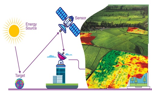
Agricultural and climate change intervention projects and programmes may fail to achieve the required outcomes and impacts due to non-use of GIS and remote sensing technology. A geographical information system (GIS) is a collection of hardware software, and procedures to collect, manage, retrieve, manipulate, analyze and display spatial data. Remote sensing is the acquisition of information about an object or phenomenon without making physical contact with the object and thus in contrast to on-site observation, especially the Earth. This training workshop will equip participants with handy skills for use in spatial and Earth Observation (EO) as a tool to integrate knowledge about climate change, agriculture, and food security in a meaningful and innovative way.Target Audience
The course is useful for professionals who use spatial data as part of their work and who need to make decisions from such data. Such professionals include: Agricultural specialists, M&E practitioners, rural development workers, program managers and students among others.Learning Outcomes / Objectives
By the end of this course the participants will be able to:- Use GIS as monitoring tool for projects and programmes activities in agriculture and climate change setup.
- Familiarize with spatial data availability
- Appreciate the role of spatial data infrastructure (SDI) in agriculture and climate change setup
- Use participatory GIS (PGIS) at community level
- Conduct agriculture and climate change modeling using GIS
- Collect data using Mobile data gathering tools
- Integrate GIS within new and existing activities in agriculture and climate change.
Duration
5 daysModules / Course Content
Module 1: Introduction Fundamentals of Monitoring and Evaluation- Definition of Monitoring and Evaluation
- Why Monitoring and Evaluation is important
- Key principles and concepts in M&E
- M&E in project lifecycle
- Participatory M&E
- Different sources of M&E data
- Qualitative data collection methods
- Quantitative data collection methods
- Participatory methods of data collection
- Data Quality Assessment
- Sources of M&E data –primary and secondary
- Sampling during data collection
- Qualitative data collection methods
- Quantitative data collection methods
- Participatory data collection methods
- Introduction to data triangulation
- Explanation of concepts
- Exploration of interlinkages between agriculture and climate change
- Principles of GIS and Remote Sensing
- Components of GIS Systems
- GIS Capabilities and Functions
- Spatial Data Infrastructure
- Introduction to GPS and Global Navigation Satellite
- Principles and concepts of GPS
- Introduction to Mobile Data gathering
- Getting started
- Survey Authoring
- GIS Mapping ODK collected data
- Online web mapping with Google maps
- Exporting to GIS /RS environment for further analysis
- Hosting the data online
- Extracting data from Satellite images,
- Extracting data from online GIS data sources
- Importing data to GIS
- Obtaining Data from topographic sheets
- Downloading Data from open street maps
- Working with spreadsheets data in GIS
- Conceptual and logical database design
- Building and coding the attributes
- Digitizing and scanning of maps
- Relating spatial and attribute data
- Adding feature to GIS data
- Reducing GIS data
- cutting points of interest in image datasets
- Transforming GIS data
- Radiometric and atmospheric correction
- Temporal normalization
- Geo-coding and geo-referencing
- Transformation
- Signature development
- Supervised Classification
- Unsupervised Classification
- Change detection
- Accuracy assessment
- Geo-processing
- Creating views and themes
- Working with themes
- Working with attribute tables
- Spatial query and analysis
- Working with charts
- Creating a map layout
- Digital Cartography and Visualization
- Components of a map
- Map design
- Symbol design
- Name design and placement
- Concept of scale
- Map projections
- Data pre-processing techniques
- Thematic mapping;
- Digital mapping
- Working with Google Maps and Fusion Tables
- Publishing into other web based platforms
- Case study of application of GIS and RS technology in agriculture and climate change
Training Methodology
The course will employ a hands-on, practical approach to ensure participants develop both conceptual understanding and technical proficiency. Each module will integrate interactive lectures, guided software demonstrations, and individual or group exercises based on real-world illustrations. Participants will receive continuous feedback and personalized coaching to reinforce learning. By the end of the training, they will have completed a mini project that demonstrates their ability to apply the acquired skills in a practical context.More Details
Upon successful completion of this course, participants will be issued a certificate.Registration
Registration as an individual (Onsite course delivery)
Click on the Register button aligned with your course dates and venue from the table provided.
Click on the Register button aligned with your course dates and venue from the table provided.